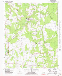
1981 Map of Speed
USGS Topo · Published 1981About this map
The town of Speed serves as the focal point of this Eastern North Carolina landscape, where the Seaboard Coast Line Railroad cuts through a terrain defined by complex water systems. Small rural communities like Coakley and Shiloh Mills are established along the edges of the Tar River and the winding Conetoe Creek. The map documents a deeply rooted community structure, evidenced by numerous local gathering places such as Acorn Hill Ch, White Chapel, and Cherry Hill Ch.
Find a feature on this map
21 named features on this map. Tap any name to fly to it.
Don’t see what you’re looking for? This feature index may not catch every label — zoom into the map to look around manually.
Map Details
Editions of this 1981 Speed Map
2 editions found
Other maps of this area

1901 · Parmele
USGS Topo · 1:62,500

1902 · Parmele
USGS Topo · 1:62,500

1902 · Tarboro
USGS Topo · 1:62,500

1903 · Tarboro
USGS Topo · 1:62,500

1953 · Norfolk
USGS Topo · 1:250,000

1953 · Rocky Mount
USGS Topo · 1:250,000

1954 · Rocky Mount
USGS Topo · 1:250,000

1960 · Draughn
USGS Topo · 1:24,000

1962 · Palmyra
USGS Topo · 1:24,000

1962 · Hobgood
USGS Topo · 1:24,000