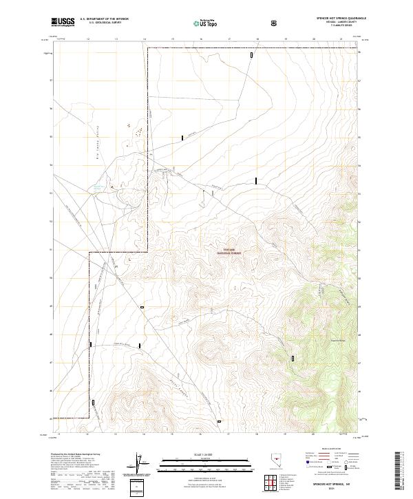
2021 Map of Spencer Hot Springs
USGS Topo · Published 2021About this map
Spencer Hot Springs sits at the western edge of the Toquima Range, where the mountain slopes meet the floor of the Big Smoky Valley. This landscape is defined by its geothermal activity and the drainage patterns of high-altitude canyons, including Petes Canyon and Rutheford Canyon. The map reveals a network of high-desert access routes, such as Petes Summit Road and Lower Petes Canyon, which serve the eastern portion of the Toiyabe National Forest. These tracks and spurs, including the Conquest Mine Spur, reflect a history of mineral exploration and land management in a geography dominated by steep elevation changes. Petes Well provides a critical water point in an otherwise arid expanse, illustrating the vital role of specific springs and wells in sustaining activity within this portion of Lander County.
Find a feature on this map
27 named features on this map. Tap any name to fly to it.
Don’t see what you’re looking for? This feature index may not catch every label — zoom into the map to look around manually.
Map Details
Editions of this 2021 Spencer Hot Springs Map
This is the sole edition of this map. No revisions or reprints were ever made.
Other maps of this area

1926 · Roberts Mountains
USGS Topo · 1:250,000

1929 · Roberts Mountains
USGS Topo · 1:250,000

1955 · Millett
USGS Topo · 1:250,000

1959 · Millett
USGS Topo · 1:250,000

1960 · Hickison Summit
USGS Topo · 1:62,500

1960 · Spencer Hot Springs
USGS Topo · 1:62,500

1960 · Dianas Punch Bowl
USGS Topo · 1:62,500

1960 · Wildcat Peak
USGS Topo · 1:62,500

1978 · Summit Mountain
USGS Topo · 1:100,000
1989 · The Monitor
USGS Topo · 1:24,000