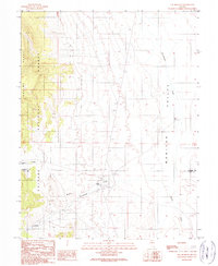
1989 Map of The Monitor
USGS Topo · Published 1990About this map
Toiyabe National Forest dominates the western landscape of this high-desert basin, where the rugged slopes of the Toquima Range meet the broad expanse of Monitor Valley. This 1989 provisional survey captures a remote ranching and resource-extraction landscape defined by ephemeral water sources and isolated human outposts. Ranching activity is centered around the Monitor Ranch and The Homestead, supported by a Landing Strip and a series of water management features including a Gaging Station and several Borrow Pits. The map reveals the quiet industrial footprint of the era through scattered Prospects and a Gravel Pit, while natural landmarks like The Monitor and drainage systems like Stoneberger Creek and Willow Creek provide the primary geographic framework for this sparsely populated corner of central Nevada.
Find a feature on this map
15 named features on this map. Tap any name to fly to it.
Don’t see what you’re looking for? This feature index may not catch every label — zoom into the map to look around manually.
Map Details
Editions of this 1989 The Monitor Map
This is the sole edition of this map. No revisions or reprints were ever made.
Other maps of this area

1926 · Roberts Mountains
USGS Topo · 1:250,000

1929 · Roberts Mountains
USGS Topo · 1:250,000

1955 · Millett
USGS Topo · 1:250,000

1959 · Millett
USGS Topo · 1:250,000

1960 · Hickison Summit
USGS Topo · 1:62,500

1960 · Spencer Hot Springs
USGS Topo · 1:62,500

1960 · Dianas Punch Bowl
USGS Topo · 1:62,500

1960 · Wildcat Peak
USGS Topo · 1:62,500

1978 · Summit Mountain
USGS Topo · 1:100,000
1989 · Dianas Punch Bowl
USGS Topo · 1:24,000