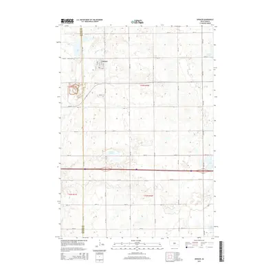
2015 Map of Spencer
USGS Topo · Published 2015About this map
Spencer stands at the heart of this East River landscape, where the prairie grid of Hanson and McCook Counties meets a scattering of glacial lakes and wetlands. The town's residential core is clearly defined by local streets such as Cordo St, Wilcox St, and Dewey St, while the surrounding agricultural lands are punctuated by water bodies like Lake Eli and the expansive Lehrman Slough. For those tracing local history, the map preserves the exact locations of Lakeside Cem to the northwest and Spencer Cem to the south. The terrain is defined by the gentle drainage of Wolf Creek and a network of section-line roads that have organized this territory since its initial settlement. Significant landmarks like Gross Lake and Macke Lake in the eastern reaches illustrate the hydrology of the Coteau des Prairies.
Find a feature on this map
34 named features on this map. Tap any name to fly to it.
Don’t see what you’re looking for? This feature index may not catch every label — zoom into the map to look around manually.
Map Details
Editions of this 2015 Spencer Map
This is the sole edition of this map. No revisions or reprints were ever made.
Other maps of this area

1899 · Alexandria
USGS Topo · 1:125,000

1955 · Sioux Falls
USGS Topo · 1:250,000

1958 · Sioux Falls
USGS Topo · 1:250,000

1964 · Salem
USGS Topo · 1:24,000

1964 · Bridgewater East
USGS Topo · 1:24,000

1971 · Unityville
USGS Topo · 1:24,000

1973 · Spencer SW
USGS Topo · 1:24,000

1973 · Farmer
USGS Topo · 1:24,000
1973 · Bridgewater West
USGS Topo · 1:24,000

1973 · Canova SE
USGS Topo · 1:24,000