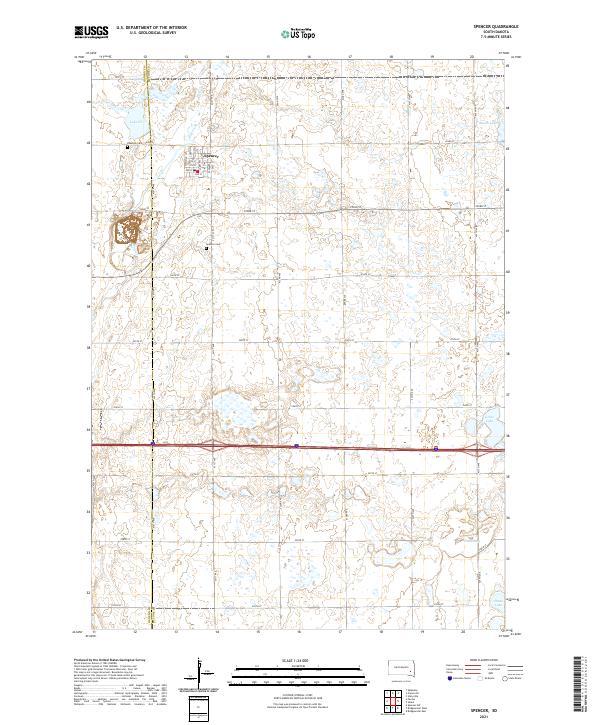
2021 Map of Spencer
USGS Topo · Published 2021About this map
Spencer stands as the primary hub of this eastern South Dakota landscape, positioned near the Hanson and McCook County line. The town's grid is clearly defined by streets such as Main St, Whitman St, and Dewey St, serving as a central point for the surrounding prairie. To the north, Lake Eli and the meandering Wolf Creek provide the principal drainage and relief for the agricultural terrain. The map reveals a high concentration of small, seasonal wetlands and prairie potholes characteristic of the region, interspersed with named water bodies like Macke Lake, Gross Lake, and Forsch Lake. For those researching local history, the placement of Spencer Cem and Lakeside Cem provides critical anchors for the area's pioneer heritage and settlement patterns as they persisted into the 21st century.
Find a feature on this map
40 named features on this map. Tap any name to fly to it.
Don’t see what you’re looking for? This feature index may not catch every label — zoom into the map to look around manually.
Map Details
Editions of this 2021 Spencer Map
This is the sole edition of this map. No revisions or reprints were ever made.
Other maps of this area

1899 · Alexandria
USGS Topo · 1:125,000

1955 · Sioux Falls
USGS Topo · 1:250,000

1958 · Sioux Falls
USGS Topo · 1:250,000

1964 · Salem
USGS Topo · 1:24,000

1964 · Bridgewater East
USGS Topo · 1:24,000

1971 · Unityville
USGS Topo · 1:24,000

1973 · Spencer SW
USGS Topo · 1:24,000

1973 · Farmer
USGS Topo · 1:24,000
1973 · Bridgewater West
USGS Topo · 1:24,000

1973 · Canova SE
USGS Topo · 1:24,000