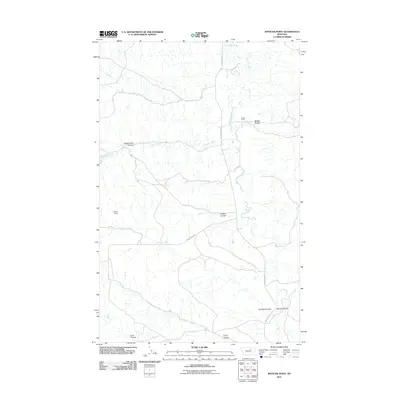
2011 Map of Spencer Point
USGS Topo · Published 2011About this map
Abels Ranch and the eponymous Spencer Point anchor this landscape in Valley County, Montana, where a network of coulees and seasonal creeks define the drainage of the Missouri River plateau. The drainage pattern is exceptionally dense, characterized by the winding path of Larb Creek and its many tributaries, including Second Creek, Third Creek, and Fourth Creek. These waterways have carved numerous named depressions into the prairie, such as McNab Coulee, Dead Horse Coulee, and Hadley Coulee.
Find a feature on this map
17 named features on this map. Tap any name to fly to it.
Don’t see what you’re looking for? This feature index may not catch every label — zoom into the map to look around manually.
Map Details
Editions of this 2011 Spencer Point Map
This is the sole edition of this map. No revisions or reprints were ever made.
Other maps of this area

1905 · Saco Special
USGS Topo · 1:62,500

1906 · Hinsdale Special Map
USGS Topo · 1:62,500

1954 · Glasgow
USGS Topo · 1:250,000

1957 · Glasgow
USGS Topo · 1:250,000

1958 · Glasgow
USGS Topo · 1:250,000
1984 · Robinson Ranch
USGS Topo · 1:24,000

1984 · Harb
USGS Topo · 1:24,000

1984 · Ashford Coulee
USGS Topo · 1:24,000
1984 · Saco
USGS Topo · 1:24,000
1984 · Flat Coulee
USGS Topo · 1:24,000