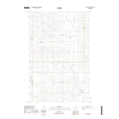
2020 Map of Spencer Point
USGS Topo · Published 2020About this map
Larb Hills rise above a landscape defined by an intricate network of drainages and high points along the Phillips and Valley County line. This modern survey illustrates the complex topography of the high plains, where water has carved out numerous coulees including Dead Horse Coulee, McNab Coulee, and Lost Coulee. The map tracks the passage of Larb Creek and its tributaries, such as Third Creek and Fourth Creek, through this remote ranching and grazing country. Transportation in this corner of Montana is limited to local routes like Larb Creek Road and Harb Trail, which navigate the high ground near Spencer Point and Pack Rat Coulee. The distribution of these roads and the naming of specific landmarks suggest a history of careful navigation through the breaks and hills that separate the various creek basins.
Find a feature on this map
22 named features on this map. Tap any name to fly to it.
Don’t see what you’re looking for? This feature index may not catch every label — zoom into the map to look around manually.
Map Details
Editions of this 2020 Spencer Point Map
This is the sole edition of this map. No revisions or reprints were ever made.
Other maps of this area

1905 · Saco Special
USGS Topo · 1:62,500

1906 · Hinsdale Special Map
USGS Topo · 1:62,500

1954 · Glasgow
USGS Topo · 1:250,000

1957 · Glasgow
USGS Topo · 1:250,000

1958 · Glasgow
USGS Topo · 1:250,000
1984 · Robinson Ranch
USGS Topo · 1:24,000

1984 · Harb
USGS Topo · 1:24,000

1984 · Ashford Coulee
USGS Topo · 1:24,000
1984 · Saco
USGS Topo · 1:24,000
1984 · Flat Coulee
USGS Topo · 1:24,000