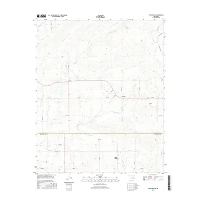
2016 Map of Spencerville
USGS Topo · Published 2016About this map
The boundary between Pushmataha and Choctaw Counties divides a landscape defined by small rural settlements and a complex web of drainage creeks. Spencerville and High Hill anchor the southern portion of the sheet, while Oleta and Corinne sit further north. These communities are linked by a grid of county roads that navigate the varying elevations between Caney Mountain and the lowlands of Spencer Creek. Several family and community burial sites, such as Hampton Chapel Cemetery and Goodwater Cemetery, are scattered throughout the region, offering significant points of interest for genealogical research.
Find a feature on this map
46 named features on this map. Tap any name to fly to it.
Don’t see what you’re looking for? This feature index may not catch every label — zoom into the map to look around manually.
Map Details
Editions of this 2016 Spencerville Map
This is the sole edition of this map. No revisions or reprints were ever made.
Other maps of this area

1901 · Alikchi
USGS Topo · 1:125,000

1950 · Mcalester
USGS Topo · 1:250,000

1962 · McAlester
USGS Topo · 1:250,000

1962 · Sobol
USGS Topo · 1:24,000

1962 · Caney Mountain
USGS Topo · 1:24,000
1962 · Swink
USGS Topo · 1:24,000

1965 · McAlester
USGS Topo · 1:250,000

1971 · Spencerville
USGS Topo · 1:24,000
1971 · Fort Towson
USGS Topo · 1:24,000
1971 · Hugo Dam
USGS Topo · 1:24,000