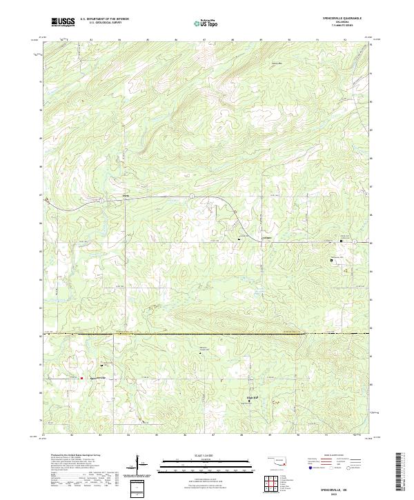
2022 Map of Spencerville
USGS Topo · Published 2022About this map
Oleta and Corinne stand as focal points in this section of southeastern Oklahoma, where the landscape is defined by the winding paths of Frazier Creek and Crooked Cr. The terrain rises toward Caney Mtn in the north, while the southern reaches descend toward the Pushmataha Co and Choctaw Co line. This survey captures a rural network of family and community landmarks, particularly evident in the high density of preserved burial sites such as the Black Jack Indian Cem and Goodwater Cem.
Find a feature on this map
64 named features on this map. Tap any name to fly to it.
Don’t see what you’re looking for? This feature index may not catch every label — zoom into the map to look around manually.
Map Details
Editions of this 2022 Spencerville Map
This is the sole edition of this map. No revisions or reprints were ever made.
Other maps of this area

1901 · Alikchi
USGS Topo · 1:125,000

1950 · Mcalester
USGS Topo · 1:250,000

1962 · McAlester
USGS Topo · 1:250,000

1962 · Sobol
USGS Topo · 1:24,000

1962 · Caney Mountain
USGS Topo · 1:24,000
1962 · Swink
USGS Topo · 1:24,000

1965 · McAlester
USGS Topo · 1:250,000

1971 · Spencerville
USGS Topo · 1:24,000
1971 · Fort Towson
USGS Topo · 1:24,000
1971 · Hugo Dam
USGS Topo · 1:24,000