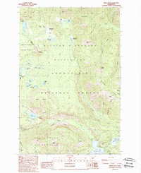
1988 Map of Spiral Butte
USGS Topo · Published 1989About this map
Spiral Butte rises as a prominent landmark in this high-altitude landscape of the Washington Cascades, where the Lewis Co Yakima Co line bisects the wilderness. The map documents a rugged transition of water and terrain, centered on the William O Douglas Wilderness and Goat Rocks Wilderness. High alpine lakes like the Twin Sisters Lakes and Cramer Lake dot the northern plateaus, while the southern portion is defined by the larger reservoirs of Rimrock Lake and Clear Lake. This late-1980s survey captures the intersection of recreation and resource management, noting established sites such as the Clear Creek Falls Campground and Camp Dudley near the Tieton River. The presence of a Quarry and Gravel Pit near the Wilderness Boundary indicates localized industry alongside the protected lands of the Gifford Pinchot National Forest and Snoqualmie National Forest.
Find a feature on this map
51 named features on this map. Tap any name to fly to it.
Don’t see what you’re looking for? This feature index may not catch every label — zoom into the map to look around manually.
Map Details
Editions of this 1988 Spiral Butte Map
2 editions found
Other maps of this area

1902 · Mount Aix
USGS Topo · 1:125,000

1904 · Mt Aix
USGS Topo · 1:125,000

1950 · Yakima
USGS Topo · 1:250,000

1958 · Yakima
USGS Topo · 1:250,000

1961 · Yakima
USGS Topo · 1:250,000

1962 · Bumping Lake
USGS Topo · 1:62,500

1962 · White Pass
USGS Topo · 1:62,500

1967 · Rimrock Lake
USGS Topo · 1:24,000

1967 · Darland Mtn
USGS Topo · 1:24,000
1971 · Timberwolf Mtn
USGS Topo · 1:24,000