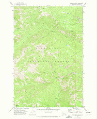
1971 Map of Timberwolf Mtn
USGS Topo · Published 1974About this map
Snoqualmie National Forest dominates this 1970s landscape, defined by a complex network of high ridges and water-carved valleys. The terrain is anchored by prominent summits such as Timberwolf Mtn, Nelson Butte, and the Rattlesnake Peaks in the southwest. A primitive transportation network consisting of a Jeep Trail, various Pack Trails, and the Nice Trail suggests a wilderness area primarily utilized for forest management and backcountry recreation rather than permanent settlement.
Find a feature on this map
26 named features on this map. Tap any name to fly to it.
Don’t see what you’re looking for? This feature index may not catch every label — zoom into the map to look around manually.
Map Details
Editions of this 1971 Timberwolf Mtn Map
3 editions found
Other maps of this area

1902 · Mount Aix
USGS Topo · 1:125,000

1904 · Mt Aix
USGS Topo · 1:125,000

1950 · Yakima
USGS Topo · 1:250,000

1958 · Yakima
USGS Topo · 1:250,000

1961 · Yakima
USGS Topo · 1:250,000

1962 · Bumping Lake
USGS Topo · 1:62,500

1962 · White Pass
USGS Topo · 1:62,500

1967 · Rimrock Lake
USGS Topo · 1:24,000

1967 · Tieton Basin
USGS Topo · 1:24,000
1971 · Cliffdell
USGS Topo · 1:24,000