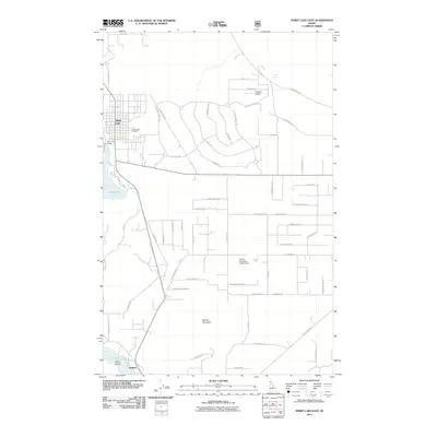
2011 Map of Spirit Lake East
USGS Topo · Published 2011About this map
Spirit Lake and its surrounding northern Idaho timberlands appear here as a landscape transition between waterfront recreation and emerging residential development. The shoreline features include the Spirit Lake Access and Greenwood Cemetery, while further south the terrain is defined by the prominent peak of Round Mountain. Aviation plays a notable role in the local infrastructure with both Treeport Airport in the north and the Round Mountain Aerodrome positioned centrally, suggesting the importance of private air travel in this forested region. At the southern edge of the map, the community of Twinlow sits near the northern reaches of Twin Lakes, where Harts Island marks the watery landscape. The road network, including Clagstone Rd and N Kelso Dr, crisscrosses the plateau between the lakes, revealing a grid of rural lanes and specialized loops like N Red Dell Loop that serve the area's residents and visitors.
Find a feature on this map
65 named features on this map. Tap any name to fly to it.
Don’t see what you’re looking for? This feature index may not catch every label — zoom into the map to look around manually.
Map Details
Editions of this 2011 Spirit Lake East Map
This is the sole edition of this map. No revisions or reprints were ever made.
Other maps of this area

1901 · Sandpoint
USGS Topo · 1:125,000

1903 · Rathdrum
USGS Topo · 1:125,000

1911 · Priest Lake
USGS Topo · 1:250,000

1911 · Sandpoint
USGS Topo · 1:125,000

1913 · Priest Lake
USGS Topo · 1:250,000

1955 · Spokane
USGS Topo · 1:250,000

1958 · Spokane
USGS Topo · 1:250,000

1958 · Sandpoint
USGS Topo · 1:250,000

1961 · Hayden
USGS Topo · 1:24,000

1961 · Rathdrum
USGS Topo · 1:24,000