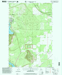
1996 Map of Spirit Lake East
USGS Topo · Published 1999About this map
Spirit Lake serves as the primary focal point for this mid-1990s landscape at the border of Bonner and Kootenai Counties. The town site shows an established grid near the Lakewood Sch and Greenwood Cem, while the surrounding timberland is managed through the Kaniksu and Coeur d'Alene National Forest Lone Mountain Seed Orchard. To the south, the northern reaches of the Twin Lakes appear, featuring localized developments at Echo Beach and Twinlow. This transition from the forested heights of Round Mountain to the open floor of Eightmile Prairie illustrates a region balancing recreation, resource management, and rural residential growth. Industrial traces remain visible on the map, including a Prospect Mine and several gravel pits, while a major Pipeline corridor cuts through the prairie toward Ramsey.
Find a feature on this map
20 named features on this map. Tap any name to fly to it.
Don’t see what you’re looking for? This feature index may not catch every label — zoom into the map to look around manually.
Map Details
Editions of this 1996 Spirit Lake East Map
This is the sole edition of this map. No revisions or reprints were ever made.
Other maps of this area

1901 · Sandpoint
USGS Topo · 1:125,000

1903 · Rathdrum
USGS Topo · 1:125,000

1911 · Priest Lake
USGS Topo · 1:250,000

1911 · Sandpoint
USGS Topo · 1:125,000

1913 · Priest Lake
USGS Topo · 1:250,000

1955 · Spokane
USGS Topo · 1:250,000

1958 · Spokane
USGS Topo · 1:250,000

1958 · Sandpoint
USGS Topo · 1:250,000

1961 · Hayden
USGS Topo · 1:24,000

1961 · Rathdrum
USGS Topo · 1:24,000