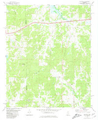
1980 Map of Splinter
USGS Topo · Published 1981About this map
The boundary between Panola Co and Lafayette Co runs vertically through this rural Mississippi landscape, dominated by the rolling hills of Terrapin Mountain and the headwaters of numerous creeks. Along the northern edge, the southern extent of Sardis Lake is visible, with a Gaging Station monitoring Clear Creek. The area is characterized by a sparse settlement pattern of small communities and crossroads such as Splinter, Orwood, and Burgess, each connected by a network of winding country roads and trails.
Find a feature on this map
28 named features on this map. Tap any name to fly to it.
Don’t see what you’re looking for? This feature index may not catch every label — zoom into the map to look around manually.
Map Details
Editions of this 1980 Splinter Map
This is the sole edition of this map. No revisions or reprints were ever made.
Other maps of this area

1940 · Oxford
USGS Topo · 1:62,500

1943 · Oxford
USGS Topo · 1:62,500

1952 · Sardis
USGS Topo · 1:62,500

1953 · Sardis
USGS Topo · 1:62,500

1954 · Oakland
USGS Topo · 1:62,500

1954 · Water Valley
USGS Topo · 1:62,500

1954 · Water Valley West
USGS Topo · 1:24,000

1955 · Water Valley
USGS Topo · 1:62,500

1956 · Tupelo
USGS Topo · 1:250,000

1958 · Tupelo
USGS Topo · 1:250,000