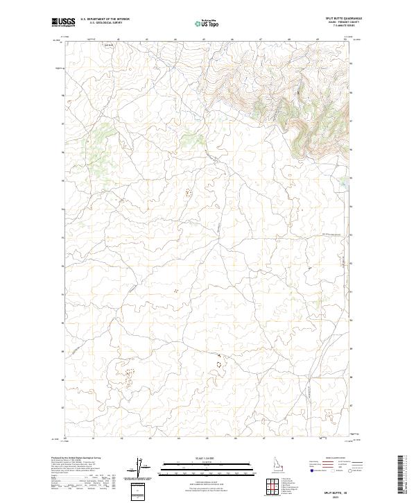
2023 Map of Split Butte
USGS Topo · Published 2023About this map
The Sand Creek Elk Refuge dominates the northeastern corner of this landscape in Fremont County, where high-elevation plains meet complex volcanic topography. A prominent geological marker, Split Butte, rises in the northwest, serving as a landmark for a region defined by its wide-open spaces and limited human development. This 2023 survey illustrates the careful balance of conservation and access, with the refuge's boundaries overlaying a grid of section lines that speak to the systematic township and range surveying of the American West.
Find a feature on this map
12 named features on this map. Tap any name to fly to it.
Don’t see what you’re looking for? This feature index may not catch every label — zoom into the map to look around manually.
Map Details
Editions of this 2023 Split Butte Map
This is the sole edition of this map. No revisions or reprints were ever made.
Other maps of this area

1955 · Ashton
USGS Topo · 1:250,000

1958 · Ashton
USGS Topo · 1:250,000

1960 · Ashton
USGS Topo · 1:250,000
1965 · Black Knoll
USGS Topo · 1:24,000

1965 · Lemon Lake
USGS Topo · 1:24,000
1965 · Split Butte
USGS Topo · 1:24,000

1965 · Blue Creek Reservoir
USGS Topo · 1:24,000

1965 · Crystal Butte
USGS Topo · 1:24,000
1965 · Bishop Mountain
USGS Topo · 1:24,000

1972 · Pine Butte
USGS Topo · 1:24,000