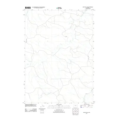
2012 Map of Split Hill SW
USGS Topo · Published 2012About this map
Kaye Oil Field sits near the center of this landscape, marking the intersection of petroleum extraction and high plains ranching in Converse County. The terrain is defined by a dendritic drainage pattern where Walker Cr and Lightning Cr carve through the open country. This 2012 survey illustrates the modern rural infrastructure required to maintain these remote operations, showing a network of unpaved access routes like Walker Creek Rd and Lightning Creek Rd that follow the natural contours of the drainage basins. Further south, Twentymile Cr crosses under 20 Mile Rd, highlighting how seasonal watercourses continue to dictate the placement of transportation corridors in this part of Wyoming.
Find a feature on this map
7 named features on this map. Tap any name to fly to it.
Don’t see what you’re looking for? This feature index may not catch every label — zoom into the map to look around manually.
Map Details
Editions of this 2012 Split Hill SW Map
This is the sole edition of this map. No revisions or reprints were ever made.
Other maps of this area

1954 · Torrington
USGS Topo · 1:250,000

1955 · Newcastle
USGS Topo · 1:250,000

1958 · Torrington
USGS Topo · 1:250,000

1958 · Newcastle
USGS Topo · 1:250,000

1970 · Bill 4 SE
USGS Topo · 1:24,000

1970 · Walker Creek School
USGS Topo · 1:24,000

1970 · Lost Springs NW
USGS Topo · 1:24,000

1970 · Bill 4 NE
USGS Topo · 1:24,000

1970 · Cooley Draw
USGS Topo · 1:24,000

1979 · Bill
USGS Topo · 1:100,000