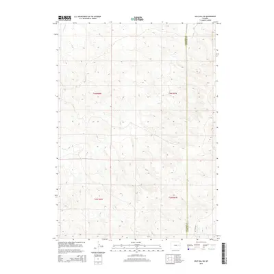
2015 Map of Split Hill SW
USGS Topo · Published 2015About this map
The Converse Co Niobrara Co border bisects this landscape, illustrating the quiet, rural character of the Wyoming high plains in the early 21st century. The terrain is defined by a dendritic network of seasonal drainages, most notably Lightning Cr in the northwest corner and Walker Cr, which meanders across the central sections. These watercourses have historically dictated the placement of ranching infrastructure in an area where water is the primary driver of land use. Human intervention remains minimal, concentrated primarily along the southern edge where Twentymile Rd provides the principal overland access across the divide between Twentymile Cr and the northern drainages. The map reveals the intricate township and range grid system, showing the surveyed boundaries of t36n r68w, t36n r67w, and their neighbors, providing essential context for land ownership and historical property research in this part of Wyoming.
Find a feature on this map
9 named features on this map. Tap any name to fly to it.
Don’t see what you’re looking for? This feature index may not catch every label — zoom into the map to look around manually.
Map Details
Editions of this 2015 Split Hill SW Map
This is the sole edition of this map. No revisions or reprints were ever made.
Other maps of this area

1954 · Torrington
USGS Topo · 1:250,000

1955 · Newcastle
USGS Topo · 1:250,000

1958 · Torrington
USGS Topo · 1:250,000

1958 · Newcastle
USGS Topo · 1:250,000

1970 · Bill 4 SE
USGS Topo · 1:24,000

1970 · Walker Creek School
USGS Topo · 1:24,000

1970 · Lost Springs NW
USGS Topo · 1:24,000

1970 · Bill 4 NE
USGS Topo · 1:24,000

1970 · Cooley Draw
USGS Topo · 1:24,000

1979 · Bill
USGS Topo · 1:100,000