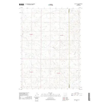
2017 Map of Split Hill SW
USGS Topo · Published 2017About this map
The high plains of eastern Wyoming are deeply etched by seasonal drainages in this landscape along the Converse Co Niobrara Co line. The terrain is defined by the winding course of Walker Creek as it flows eastward across the northern half of the quadrangle, while Twentymile Creek cuts through the southeastern corner. This area represents the intersection of ranching traditions and modern energy exploration, where long-established range tracks meet infrastructure like the Flying J Oil Field Rd. A network of rural routes, including Lightning Creek Rd and 20 Mile Rd, provides the primary access through this dissected topography, following the natural contours of the draws and ridges that characterize the regional geography between the Cheyenne River and the North Platte.
Find a feature on this map
12 named features on this map. Tap any name to fly to it.
Don’t see what you’re looking for? This feature index may not catch every label — zoom into the map to look around manually.
Map Details
Editions of this 2017 Split Hill SW Map
This is the sole edition of this map. No revisions or reprints were ever made.
Other maps of this area

1954 · Torrington
USGS Topo · 1:250,000

1955 · Newcastle
USGS Topo · 1:250,000

1958 · Torrington
USGS Topo · 1:250,000

1958 · Newcastle
USGS Topo · 1:250,000

1970 · Bill 4 SE
USGS Topo · 1:24,000

1970 · Walker Creek School
USGS Topo · 1:24,000

1970 · Lost Springs NW
USGS Topo · 1:24,000

1970 · Bill 4 NE
USGS Topo · 1:24,000

1970 · Cooley Draw
USGS Topo · 1:24,000

1979 · Bill
USGS Topo · 1:100,000