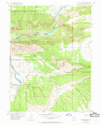
1955 Map of Split Mountain
USGS Topo · Published 1969About this map
The Green River carves a dramatic path through the heart of Dinosaur National Monument, defining a landscape where geology and early ranching intersect. This mid-century survey illustrates the river's treacherous descent through Split Mountain canyon, identifying a series of formidable whitewater features including Moonshine Rapids, Inglesby Rapids, and the provocatively named SOB Rapids. While the northern half of the sheet is dominated by the steep walls of Mitten Canyon and the Yampa Plateau, the southern reaches show signs of human activity in this remote Utah terrain.
Find a feature on this map
32 named features on this map. Tap any name to fly to it.
Don’t see what you’re looking for? This feature index may not catch every label — zoom into the map to look around manually.
Map Details
Editions of this 1955 Split Mountain Map
2 editions found
Other maps of this area

1885 · Ashley
USGS Topo · 1:250,000

1907 · Jensen
USGS Topo · 1:125,000

1910 · Jensen
USGS Topo · 1:125,000

1954 · Vernal
USGS Topo · 1:250,000

1955 · Island Park
USGS Topo · 1:24,000

1955 · Stuntz Reservoir
USGS Topo · 1:24,000

1955 · Jones Hole
USGS Topo · 1:24,000

1955 · Split Mountain
USGS Topo · 1:24,000

1958 · Vernal
USGS Topo · 1:250,000

1960 · Vernal
USGS Topo · 1:250,000