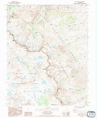
1990 Map of Split Mtn
USGS Topo · Published 1995About this map
The High Sierra crest forms a dramatic divide on this 1990 survey, marking the boundary between Kings Canyon National Park and the Inyo National Forest. High-altitude geology and alpine hydrology dominate the landscape, with the Pacific Crest National Scenic Trail threading through the Upper Basin and crossing the formidable Mather Pass. The eastern slopes within the John Muir Wilderness are characterized by steep drainages like Big Pine Creek and Tinemaha Creek, leading up to some of the highest points in the range.
Find a feature on this map
46 named features on this map. Tap any name to fly to it.
Don’t see what you’re looking for? This feature index may not catch every label — zoom into the map to look around manually.
Map Details
Editions of this 1990 Split Mtn Map
This is the sole edition of this map. No revisions or reprints were ever made.
Other maps of this area

1903 · Tehipite
USGS Topo · 1:125,000

1905 · Tehipite
USGS Topo · 1:125,000

1907 · Mt. Whitney
USGS Topo · 1:125,000

1912 · Mt. Goddard
USGS Topo · 1:125,000

1913 · Bishop
USGS Topo · 1:125,000

1919 · Mt. Whitney
USGS Topo · 1:125,000

1937 · Mt. Whitney
USGS Topo · 1:125,000

1947 · Mariposa
USGS Topo · 1:250,000

1948 · Fresno
USGS Topo · 1:250,000

1948 · Mariposa
USGS Topo · 1:250,000