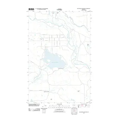
2011 Map of Split Rock Junction
USGS Topo · Published 2011About this map
Willow Creek Reservoir dominates the center of this Montana landscape, where intricate water management systems define the local geography. The Willow Creek Dam regulates the reservoir, feeding into a network of irrigation works including the Kirkaldie Canal and Floweree Canal. This 2011 survey reveals a heavily engineered environment where even small tributaries are managed by structures like Peach Fuzz Dam, Gordan Lightfoot Dam, and Young Sun Dam.
Find a feature on this map
40 named features on this map. Tap any name to fly to it.
Don’t see what you’re looking for? This feature index may not catch every label — zoom into the map to look around manually.
Map Details
Editions of this 2011 Split Rock Junction Map
This is the sole edition of this map. No revisions or reprints were ever made.
Other maps of this area

1903 · Saypo
USGS Topo · 1:125,000

1903 · Coopers Lake
USGS Topo · 1:125,000

1920 · Choteau
USGS Topo · 1:125,000

1943 · Hogan
USGS Topo · 1:125,000

1955 · Choteau
USGS Topo · 1:250,000

1957 · Choteau
USGS Topo · 1:250,000

1958 · Choteau
USGS Topo · 1:250,000

1958 · Barr Creek
USGS Topo · 1:24,000
1958 · Split Rock Lake
USGS Topo · 1:24,000

1960 · Gilman
USGS Topo · 1:62,500