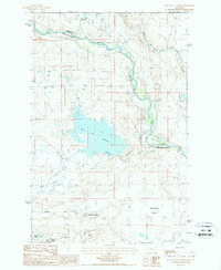
1986 Map of Split Rock Junction
USGS Topo · Published 1987About this map
Sun River water management defines this portion of the Montana high plains, where the Willow Creek Reservoir collects the flows of Willow Creek and the North Fork Willow Creek. This 1980s survey captures a landscape structured by irrigation and transport, including several Canals and water control structures like the Diversion Dam and various headgates. The geography is punctuated by distinctive terrain features such as Carey Butte, Sandy Butte, and the expansive Alkali Flats.
Find a feature on this map
25 named features on this map. Tap any name to fly to it.
Don’t see what you’re looking for? This feature index may not catch every label — zoom into the map to look around manually.
Map Details
Editions of this 1986 Split Rock Junction Map
This is the sole edition of this map. No revisions or reprints were ever made.
Other maps of this area

1903 · Saypo
USGS Topo · 1:125,000

1903 · Coopers Lake
USGS Topo · 1:125,000

1920 · Choteau
USGS Topo · 1:125,000

1943 · Hogan
USGS Topo · 1:125,000

1955 · Choteau
USGS Topo · 1:250,000

1957 · Choteau
USGS Topo · 1:250,000

1958 · Choteau
USGS Topo · 1:250,000

1958 · Barr Creek
USGS Topo · 1:24,000
1958 · Split Rock Lake
USGS Topo · 1:24,000

1960 · Gilman
USGS Topo · 1:62,500