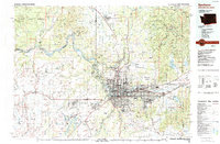
1987 Map of Spokane
USGS Topo · Published 1987About this map
The city of Spokane and the sprawling Spokane Valley dominate this late 20th-century landscape, illustrating the region's role as a major Pacific Northwest hub. The map shows the significant military and industrial presence of the era, anchored by Fairchild Air Force Base and the Spokane International Airport to the west. A complex transportation network is visible, where the Burlington Northern and Union Pacific railroads intersect with Interstate 90, facilitating movement through the valley toward the Washington-Idaho border.
Find a feature on this map
115 named features on this map. Tap any name to fly to it.
Don’t see what you’re looking for? This feature index may not catch every label — zoom into the map to look around manually.
Map Details
Editions of this 1987 Spokane Map
This is the sole edition of this map. No revisions or reprints were ever made.
Other maps of this area

1901 · Sandpoint
USGS Topo · 1:125,000

1901 · Spokane
USGS Topo · 1:125,000

1903 · Oakesdale
USGS Topo · 1:125,000

1903 · Rathdrum
USGS Topo · 1:125,000

1905 · Oakesdale
USGS Topo · 1:125,000

1911 · Priest Lake
USGS Topo · 1:250,000

1911 · Sandpoint
USGS Topo · 1:125,000

1913 · Priest Lake
USGS Topo · 1:250,000

1927 · Chewelah
USGS Topo · 1:125,000

1930 · Chewelah
USGS Topo · 1:125,000