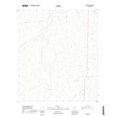
2019 Map of Spoon Draw
USGS Topo · Published 2019About this map
Las Moras Cr carves a winding path through this Menard County landscape, defining the drainage patterns and historical ranching corridors of the region. The map reveals a network of rural routes and family-named landmarks that speak to the long-standing land use in this part of Texas. Pine Gate serves as a central point of reference along FM 2291, while the presence of Vaughn Spring highlights the importance of reliable water sources in this semi-arid terrain. Named features such as Harris Hollow and Spoon Draw illustrate the relief and natural geographic markers used by local inhabitants for generations. Several local roads, including Ellis School Ln and Thomerson Ln, provide clues to the locations of earlier homesteads and community structures that once anchored these remote rural stretches.
Find a feature on this map
16 named features on this map. Tap any name to fly to it.
Don’t see what you’re looking for? This feature index may not catch every label — zoom into the map to look around manually.
Map Details
Editions of this 2019 Spoon Draw Map
This is the sole edition of this map. No revisions or reprints were ever made.
Other maps of this area

1954 · Llano
USGS Topo · 1:250,000

1955 · Llano
USGS Topo · 1:250,000

1956 · Llano
USGS Topo · 1:250,000

1970 · Clear Creek Lake
USGS Topo · 1:24,000

1970 · San Augustine Draw
USGS Topo · 1:24,000

1970 · Julio Draw
USGS Topo · 1:24,000
1970 · Rust Ranch
USGS Topo · 1:24,000

1970 · Brewer Hollow
USGS Topo · 1:24,000

1970 · East Elm Creek
USGS Topo · 1:24,000
1970 · Spoon Draw
USGS Topo · 1:24,000