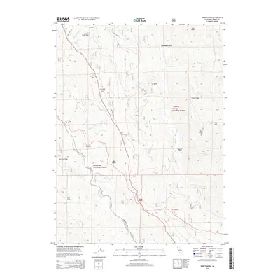
2015 Map of Sportshaven
USGS Topo · Published 2015About this map
S Fork Mtn serves as the dominant spine of this Trinity County landscape, separating the drainage systems of the Mad River to the west and the South Fork Trinity River to the east. The terrain is marked by a series of high-elevation gaps and buttes, including Lamb Gap, Chris Gap, Norse Butte, and Pine Butte. Settlement patterns are defined by small, isolated clearings and homestead sites, notably Sportshaven along the Mad River Ridge, and several locations designated as "places," such as Sids Place, Graham Place, and McClellan Place.
Find a feature on this map
44 named features on this map. Tap any name to fly to it.
Don’t see what you’re looking for? This feature index may not catch every label — zoom into the map to look around manually.
Map Details
Editions of this 2015 Sportshaven Map
This is the sole edition of this map. No revisions or reprints were ever made.
Other maps of this area

1909 · Big Bar
USGS Topo · 1:96,000

1914 · Pilot Creek
USGS Topo · 1:62,500

1915 · Big Bar and Vicinity
USGS Topo · 1:250,000

1918 · Anada
USGS Topo · 1:62,500

1931 · Hoaglin
USGS Topo · 1:96,000

1935 · Hoaglin
USGS Topo · 1:125,000

1949 · Blocksburg
USGS Topo · 1:62,500

1951 · Blocksburg
USGS Topo · 1:62,500

1951 · Pilot Creek
USGS Topo · 1:62,500

1951 · Hyampom
USGS Topo · 1:62,500