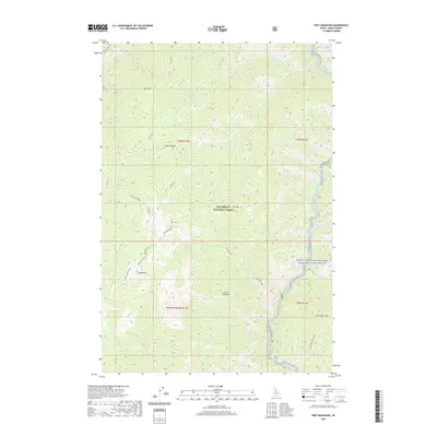
2020 Map of Spot Mountain
USGS Topo · Published 2020About this map
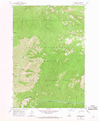
Bitterroot National Forest encompasses this high-elevation Idaho landscape, where steep drainages and prominent peaks define the geography. The historic Nez Perce Indian Trail traverses the southeastern quadrant, crossing the slopes of Nick Wynn Mtn. The hydrology is dominated by the Selway River in the northeast and the Middle Fork Clearwater Wild and Scenic River corridor, fed by numerous seasonal and perennial flows including Crooked Cr and Wynn Cr. High-country landmarks such as Spot Mountain, Pyramid Mtn, and Mt Aura offer significant orientation points for the region. The map highlights the intersection of primitive transport routes like Nat For Dev Rd 6223 and more traditional footpaths, reflecting the area's long history of seasonal movement and forest management.
Find a feature on this map
31 named features on this map. Tap any name to fly to it.
Don’t see what you’re looking for? This feature index may not catch every label — zoom into the map to look around manually.
Map Details
Editions of this 2020 Spot Mountain Map
This is the sole edition of this map. No revisions or reprints were ever made.
Other maps of this area

1956 · Elk City
USGS Topo · 1:250,000

1960 · Elk City
USGS Topo · 1:250,000

1962 · Beaver Jack Mtn
USGS Topo · 1:24,000

1966 · Spot Mountain
USGS Topo · 1:24,000

1966 · Three Prong Mountain
USGS Topo · 1:24,000
1966 · Wylies Peak
USGS Topo · 1:24,000
1966 · Burnt Strip Mtn
USGS Topo · 1:24,000
1966 · Gardiner Peak
USGS Topo · 1:24,000
1966 · Mt George
USGS Topo · 1:24,000

1978 · Magruder Mtn
USGS Topo · 1:24,000