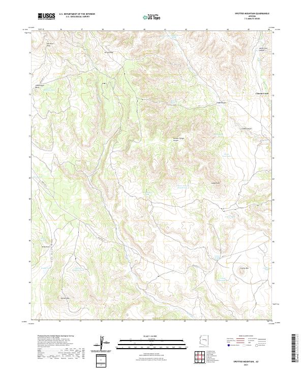
2021 Map of Spotted Mountain
USGS Topo · Published 2021About this map
Spotted Mtn and Lonely Mtn anchor this high-elevation landscape in Navajo County, defined by a complex network of seasonal drainages and remote springs. The region is characterized by deep topographic relief where Cibecue Creek and the Salt River Draw have carved distinct paths through the terrain. A sophisticated water management system for ranching or land use is evident through numerous tanks, such as Spotted Mountain Tank, Red Canyon Tank, and Kelly Draw Tank, which utilize the natural runoff from canyons like Truax Canyon and Caddo Canyon. Transportation is limited to rugged corridors like Indian Rte 12 and Indian Rte 33, highlighting the area's isolation. Key landmarks like Grasshopper Butte and Caddo Point serve as prominent navigational aids in a territory where traditional water sources like Water Bag Spring and Forty-two Spring have historical importance.
Find a feature on this map
40 named features on this map. Tap any name to fly to it.
Don’t see what you’re looking for? This feature index may not catch every label — zoom into the map to look around manually.
Map Details
Editions of this 2021 Spotted Mountain Map
This is the sole edition of this map. No revisions or reprints were ever made.
Other maps of this area

1886 · Holbrook
USGS Topo · 1:250,000

1893 · Holbrook
USGS Topo · 1:250,000

1922 · Chrysotile
USGS Topo · 1:125,000

1946 · Blue House Mtn
USGS Topo · 1:62,500

1951 · Blue House Mtn
USGS Topo · 1:62,500

1954 · Holbrook
USGS Topo · 1:250,000

1954 · Mesa
USGS Topo · 1:250,000

1957 · Mesa
USGS Topo · 1:250,000

1957 · Holbrook
USGS Topo · 1:250,000

1958 · Mesa
USGS Topo · 1:250,000