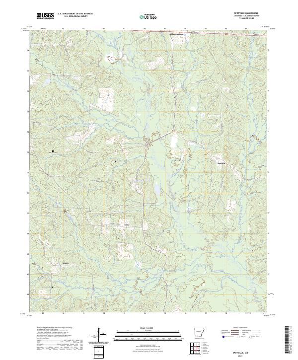
2024 Map of Spotville
USGS Topo · Published 2024About this map
Corney Bayou and its numerous tributaries dominate the landscape of southern Columbia County, defining the drainage patterns around small Arkansas settlements like Spotville and Village Junction. This rural area is marked by a network of local roads such as Columbia Road 34 and Columbia Road 32 that connect dispersed communities and family-named sites. For genealogists and local historians, the map identifies several significant burial grounds, including Saint Marks Cem, Baker Cem, and McClendon Cem, which serve as permanent markers of the region's heritage. The terrain is characterized by a dense system of waterways like Little Corney Bayou and Hurricane Creek, which have historically influenced the placement of homesteads and the development of the timber and agricultural lands in the Noxobe and Talley vicinity.
Find a feature on this map
46 named features on this map. Tap any name to fly to it.
Don’t see what you’re looking for? This feature index may not catch every label — zoom into the map to look around manually.
Map Details
Editions of this 2024 Spotville Map
This is the sole edition of this map. No revisions or reprints were ever made.
Other maps of this area

1953 · El Dorado
USGS Topo · 1:250,000

1957 · El Dorado
USGS Topo · 1:250,000

1958 · El Dorado
USGS Topo · 1:250,000

1960 · El Dorado
USGS Topo · 1:250,000

1962 · Mt Holly
USGS Topo · 1:24,000

1964 · Louann
USGS Topo · 1:62,500

1966 · Village
USGS Topo · 1:24,000

1966 · Calhoun
USGS Topo · 1:24,000

1966 · Spotville
USGS Topo · 1:24,000
1968 · Magnolia
USGS Topo · 1:24,000