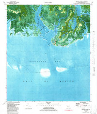
1982 Map of Sprague Island
USGS Topo · Published 1984About this map
St Marks National Wildlife Refuge dominates this coastal survey, where the terrestrial landscape of Wakulla County dissolves into the intricate marshlands and bayous of Apalachee Bay. The map highlights the historic St Marks Lighthouse standing sentinel near the Spanish Hole, a critical landmark for maritime navigation at the mouth of the St Marks River. The inclusion of the Forbes Purchase Line provides a significant genealogical and land-tenure reference, marking the boundary of one of the largest land grants in Florida's history.
Find a feature on this map
63 named features on this map. Tap any name to fly to it.
Don’t see what you’re looking for? This feature index may not catch every label — zoom into the map to look around manually.
Map Details
Editions of this 1982 Sprague Island Map
2 editions found
Other maps of this area

1940 · Arran
USGS Topo · 1:62,500

1943 · Arran
USGS Topo · 1:62,500

1943 · Lighthouse Point
USGS Topo · 1:24,000

1945 · Lighthouse Point
USGS Topo · 1:31,680

1949 · Apalachicola
USGS Topo · 1:250,000

1954 · Sprague Island
USGS Topo · 1:24,000

1954 · St. Marks NE
USGS Topo · 1:24,000

1954 · St. Marks
USGS Topo · 1:24,000

1954 · Cobb Rocks
USGS Topo · 1:24,000

1954 · Tallahassee
USGS Topo · 1:250,000