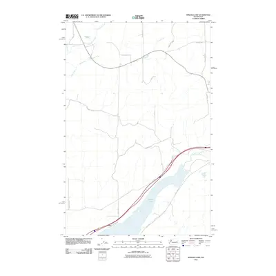
2011 Map of Sprague Lake
USGS Topo · Published 2011About this map
Sprague Lake dominates the southeastern portion of this landscape, its waters fed and drained by a complex network of seasonal and perennial waterways. This 2011 survey illustrates the rural character of the area where Crab Creek and Sheep Creek traverse the plateau. The small settlement at Pifer serves as a focal point along the transportation corridor that parallels the lake's western shore. Further north, the terrain is defined by smaller water bodies such as Eastman Pond and the branching paths of Buttermilk Creek and Lords Creek. This topographical study reveals the intricate drainage patterns of the Channeled Scablands, where various rural roads like Doerschlag Rd E and Kintschi Rd provide access to the vast open acreage between these distinct hydrological features.
Find a feature on this map
25 named features on this map. Tap any name to fly to it.
Don’t see what you’re looking for? This feature index may not catch every label — zoom into the map to look around manually.
Map Details
Editions of this 2011 Sprague Lake Map
This is the sole edition of this map. No revisions or reprints were ever made.
Other maps of this area

1953 · Ritzville
USGS Topo · 1:250,000

1954 · Sprague
USGS Topo · 1:62,500

1955 · Spokane
USGS Topo · 1:250,000

1958 · Spokane
USGS Topo · 1:250,000

1959 · Ritzville
USGS Topo · 1:250,000

1964 · Lamont NW
USGS Topo · 1:24,000

1964 · Karakul Hills
USGS Topo · 1:24,000

1964 · Palm Lake
USGS Topo · 1:24,000

1965 · Ritzville
USGS Topo · 1:250,000

1969 · Sprague Lake
USGS Topo · 1:24,000