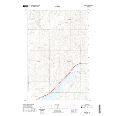
2020 Map of Sprague Lake
USGS Topo · Published 2020About this map
Sprague Lake dominates the southern landscape of this 2020 survey, where the border of Lincoln and Adams Counties cuts through the water. The small settlement of Pifer sits along the southern shore, positioned near a key transportation corridor that includes a major rail line and several access routes like Sprague Lake Resort Rd. To the north, the terrain transitions into a complex series of coulees and ridges, drained by numerous intermittent streams including Sheep Creek, Negro Creek, and Lords Creek. This region of Eastern Washington is characterized by its agricultural and ranching infrastructure, evidenced by the extensive grid of named local roads such as Costello Rd and Max Harder Rd. Smaller water bodies like Eastman Pond and Clear Lake dot the landscape, reflecting the unique geological drainage patterns of the Channeled Scablands.
Find a feature on this map
35 named features on this map. Tap any name to fly to it.
Don’t see what you’re looking for? This feature index may not catch every label — zoom into the map to look around manually.
Map Details
Editions of this 2020 Sprague Lake Map
This is the sole edition of this map. No revisions or reprints were ever made.
Other maps of this area

1953 · Ritzville
USGS Topo · 1:250,000

1954 · Sprague
USGS Topo · 1:62,500

1955 · Spokane
USGS Topo · 1:250,000

1958 · Spokane
USGS Topo · 1:250,000

1959 · Ritzville
USGS Topo · 1:250,000

1964 · Lamont NW
USGS Topo · 1:24,000

1964 · Karakul Hills
USGS Topo · 1:24,000

1964 · Palm Lake
USGS Topo · 1:24,000

1965 · Ritzville
USGS Topo · 1:250,000

1969 · Sprague Lake
USGS Topo · 1:24,000