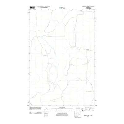
2011 Map of Sprague Lake NE
USGS Topo · Published 2011About this map
Canby sits at the northern edge of this Lincoln County landscape, where the agricultural plateaus of eastern Washington are carved by a network of drainage channels. The area is defined by the winding paths of Crab Creek, Rock Creek, and Buttermilk Creek, which create a complex riparian system amidst the grid of rural roads. This 2011 survey by the U.S. Geological Survey illustrates a sparsely populated region where transportation is dictated by the natural topography, with routes like Canby Bridge Rd N and Kintschi Rd N connecting isolated homesteads.
Find a feature on this map
22 named features on this map. Tap any name to fly to it.
Don’t see what you’re looking for? This feature index may not catch every label — zoom into the map to look around manually.
Map Details
Editions of this 2011 Sprague Lake NE Map
This is the sole edition of this map. No revisions or reprints were ever made.
Other maps of this area

1945 · Reardan
USGS Topo · 1:62,500

1953 · Reardan
USGS Topo · 1:62,500

1953 · Ritzville
USGS Topo · 1:250,000

1954 · Sprague
USGS Topo · 1:62,500

1955 · Spokane
USGS Topo · 1:250,000

1958 · Spokane
USGS Topo · 1:250,000

1959 · Ritzville
USGS Topo · 1:250,000

1965 · Ritzville
USGS Topo · 1:250,000

1969 · Bluestem
USGS Topo · 1:24,000

1969 · Sprague Lake
USGS Topo · 1:24,000