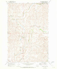
1969 Map of Sprague Lake NE
USGS Topo · Published 1972About this map
Crab Creek and its many tributaries, including Buttermilk Creek and Rock Creek, dominate this Lincoln County landscape, carving through the terrain near the small settlement of Canby. The agricultural character of the late 1960s is evident in the presence of a Grain Elevator and Storage Bins near the Burlington Northern railroad line, which skirts the northern edge of the quadrangle.
Find a feature on this map
22 named features on this map. Tap any name to fly to it.
Don’t see what you’re looking for? This feature index may not catch every label — zoom into the map to look around manually.
Map Details
Editions of this 1969 Sprague Lake NE Map
This is the sole edition of this map. No revisions or reprints were ever made.
Other maps of this area

1945 · Reardan
USGS Topo · 1:62,500

1953 · Reardan
USGS Topo · 1:62,500

1953 · Ritzville
USGS Topo · 1:250,000

1954 · Sprague
USGS Topo · 1:62,500

1955 · Spokane
USGS Topo · 1:250,000

1958 · Spokane
USGS Topo · 1:250,000

1959 · Ritzville
USGS Topo · 1:250,000

1965 · Ritzville
USGS Topo · 1:250,000

1969 · Bluestem
USGS Topo · 1:24,000

1969 · Sprague Lake
USGS Topo · 1:24,000