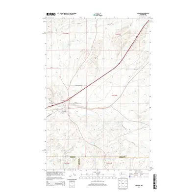
2014 Map of Sprague
USGS Topo · Published 2014About this map
Sprague serves as the primary hub of this landscape, situated at the intersection of local transportation routes and the winding Negro Cr. The town's surroundings are characterized by a series of small, scattered water bodies including Lye Lake, Ringwood Lake, and Pine Tree Lake, which reflect the unique hydrology of the Channeled Scablands. This 2014 survey documents the convergence of Lincoln, Adams, and Whitman counties, highlighting a rural landscape where infrastructure like the Redfern Aerodrome and Old Airport Rd sit alongside historical community markers.
Find a feature on this map
35 named features on this map. Tap any name to fly to it.
Don’t see what you’re looking for? This feature index may not catch every label — zoom into the map to look around manually.
Map Details
Editions of this 2014 Sprague Map
This is the sole edition of this map. No revisions or reprints were ever made.
Other maps of this area

1953 · Ritzville
USGS Topo · 1:250,000

1954 · Sprague
USGS Topo · 1:62,500

1955 · Spokane
USGS Topo · 1:250,000

1958 · Spokane
USGS Topo · 1:250,000

1959 · Ritzville
USGS Topo · 1:250,000

1964 · Lamont NE
USGS Topo · 1:24,000

1964 · Lamont NW
USGS Topo · 1:24,000

1964 · Palm Lake
USGS Topo · 1:24,000

1965 · Ritzville
USGS Topo · 1:250,000

1969 · Sprague Lake
USGS Topo · 1:24,000