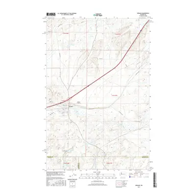
2017 Map of Sprague
USGS Topo · Published 2017About this map
Sprague serves as the central hub of this Eastern Washington landscape, where the town's street grid, including Poplar St and Oak St, transitions into a surrounding network of agricultural and natural terrain. The map documents the local geography at the meeting point of Lincoln, Adams, and Whitman counties, featuring a concentration of water bodies such as Pine Tree Lake and Fourth of July Lake. Cultural markers for genealogists and local historians include Lake View Cem and Macabee Cem situated just west of the town center. The transportation corridors are dominated by the interstate path and the Redfern Aerodrome, while the varied hydrography of the region is evident in the winding course of Negro Cr and the topographical distinctiveness of The Narrows. This survey details the land use patterns as of 2017, illustrating the persistent importance of both regional transit and local water resources in the semi-arid interior.
Find a feature on this map
35 named features on this map. Tap any name to fly to it.
Don’t see what you’re looking for? This feature index may not catch every label — zoom into the map to look around manually.
Map Details
Editions of this 2017 Sprague Map
This is the sole edition of this map. No revisions or reprints were ever made.
Other maps of this area

1953 · Ritzville
USGS Topo · 1:250,000

1954 · Sprague
USGS Topo · 1:62,500

1955 · Spokane
USGS Topo · 1:250,000

1958 · Spokane
USGS Topo · 1:250,000

1959 · Ritzville
USGS Topo · 1:250,000

1964 · Lamont NE
USGS Topo · 1:24,000

1964 · Lamont NW
USGS Topo · 1:24,000

1964 · Palm Lake
USGS Topo · 1:24,000

1965 · Ritzville
USGS Topo · 1:250,000

1969 · Sprague Lake
USGS Topo · 1:24,000