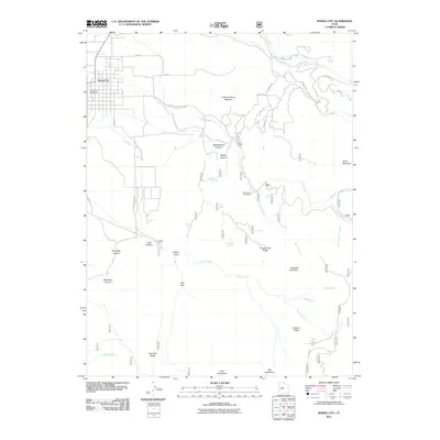
2011 Map of Spring City
USGS Topo · Published 2011About this map
Spring City serves as the primary settlement on this landscape, with its residential grid extending north toward Oak Creek and Twin Creek. The topographic survey reveals a terrain defined by steep canyons and named ridges that descend from the high ground of Knob Mountain and Haystack Mountain. Natural water sources are vital to the local geography, represented by numerous springs including Black Willow Spring, Wileys Spring, and Oak Ridge Spring.
Find a feature on this map
47 named features on this map. Tap any name to fly to it.
Don’t see what you’re looking for? This feature index may not catch every label — zoom into the map to look around manually.
Map Details
Editions of this 2011 Spring City Map
This is the sole edition of this map. No revisions or reprints were ever made.
Other maps of this area

1885 · Manti
USGS Topo · 1:250,000

1895 · Manti
USGS Topo · 1:250,000

1951 · Moroni
USGS Topo · 1:62,500

1956 · Price
USGS Topo · 1:250,000

1960 · Price
USGS Topo · 1:250,000

1962 · Price
USGS Topo · 1:250,000

1965 · Huntington Reservoir
USGS Topo · 1:24,000

1966 · Spring City
USGS Topo · 1:24,000

1966 · Chester
USGS Topo · 1:24,000
1966 · Ephraim
USGS Topo · 1:24,000