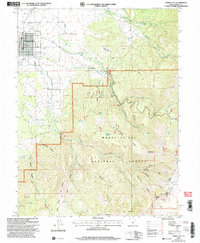
2001 Map of Spring City
USGS Topo · Published 2004About this map
Spring City serves as the focal point for this survey of the Sanpete Valley, showing the town's distinct grid layout and its immediate reliance on the drainage from the eastern mountains. Irrigation is the defining human footprint here, evidenced by a complex network including the Mill Race Ditch, Point Ditch, and Last Chance Ditch, which redirect water from Oak Creek and Cedar Creek toward the valley floor.
Find a feature on this map
51 named features on this map. Tap any name to fly to it.
Don’t see what you’re looking for? This feature index may not catch every label — zoom into the map to look around manually.
Map Details
Editions of this 2001 Spring City Map
This is the sole edition of this map. No revisions or reprints were ever made.
Other maps of this area

1885 · Manti
USGS Topo · 1:250,000

1895 · Manti
USGS Topo · 1:250,000

1951 · Moroni
USGS Topo · 1:62,500

1956 · Price
USGS Topo · 1:250,000

1960 · Price
USGS Topo · 1:250,000

1962 · Price
USGS Topo · 1:250,000

1965 · Huntington Reservoir
USGS Topo · 1:24,000

1966 · Spring City
USGS Topo · 1:24,000

1966 · Chester
USGS Topo · 1:24,000
1966 · Ephraim
USGS Topo · 1:24,000