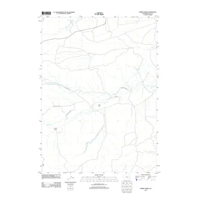
2012 Map of Spring Creek
USGS Topo · Published 2012About this map
Pollard Cr and Spring Cr define the northern drainage patterns of this Platte County landscape, where the high plains of Wyoming are marked by a network of seasonal draws and creeks. The terrain is structured by prominent landmarks such as Deer Hill in the southwest and the expansive Sand Draw near the center of the quadrangle. Transport in the early 21st century relied on a series of rural routes including N Horseshoe Rd and S Horseshoe Creek Rd, which parallel the winding path of Horseshoe Cr. This topographic study by the U.S. Geological Survey illustrates the intersection of water resources and ranch access roads, showing how the land is segmented by features like Reeder Draw and the various branches of the N Horseshoe Cr.
Find a feature on this map
14 named features on this map. Tap any name to fly to it.
Don’t see what you’re looking for? This feature index may not catch every label — zoom into the map to look around manually.
Map Details
Editions of this 2012 Spring Creek Map
This is the sole edition of this map. No revisions or reprints were ever made.
Other maps of this area

1943 · Esterbrook
USGS Topo · 1:62,500

1945 · Esterbrook
USGS Topo · 1:62,500

1949 · Cedar Hill
USGS Topo · 1:24,000

1949 · Spring Creek
USGS Topo · 1:24,000

1949 · Dilts Ranch
USGS Topo · 1:24,000

1950 · Glendo
USGS Topo · 1:24,000

1950 · Spring Creek
USGS Topo · 1:24,000
1950 · Dilts Ranch
USGS Topo · 1:24,000

1950 · Coleman Butte
USGS Topo · 1:24,000

1950 · Cottonwood Falls
USGS Topo · 1:24,000