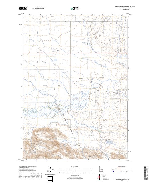
2023 Map of Spring Creek Reservoir
USGS Topo · Published 2023About this map
The Camas Prairie floor meets the northern ascent of the Mount Bennett Hills in this Idaho landscape, where high-desert water management defines the settlement pattern. Irrigation and livestock ranching are evidenced by the network of named reservoirs, including Spring Creek Reservoir and Neilsen Reservoir, which capture runoff from the southern heights. The topography shifts from the flat alluvial basin of Camas Creek to the intricate drainages of Minear Creek and Knowlton Creek. Local transit is oriented around a grid of rural routes such as Selby Rd and Frostenson Rd, which connect the small clusters of Selby and Rands. To the southwest, the Manard Cem stands as a focal point for family history, situated at the base of the hills near the intersection of several historic township boundaries.
Find a feature on this map
44 named features on this map. Tap any name to fly to it.
Don’t see what you’re looking for? This feature index may not catch every label — zoom into the map to look around manually.
Map Details
Editions of this 2023 Spring Creek Reservoir Map
This is the sole edition of this map. No revisions or reprints were ever made.
Other maps of this area

1955 · Hailey
USGS Topo · 1:250,000

1957 · Fairfield
USGS Topo · 1:62,500

1957 · Thorn Creek
USGS Topo · 1:62,500

1957 · Davis Mountain
USGS Topo · 1:62,500

1957 · Blaine
USGS Topo · 1:62,500

1959 · Hailey
USGS Topo · 1:250,000

1962 · Hailey
USGS Topo · 1:250,000
1986 · Phillips
USGS Topo · 1:24,000
1986 · Thorn Creek Reservoir
USGS Topo · 1:24,000
1986 · Fir Grove Mountain
USGS Topo · 1:24,000