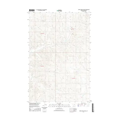
2017 Map of Spring Creek School
USGS Topo · Published 2017About this map
Spring Creek School stands as a primary landmark in this remote section of Garfield County, marking a site of community and education within a landscape defined by an intricate network of coulees and seasonal waterways. The drainage patterns of Spring Creek and Indian Creek carve through the northern terrain, while Wolf Creek and the long reaches of Nancy Russell Creek dominate the central and southern portions. The presence of Dry Fork Nancy Russell Creek underscores the arid character of this high plains environment. Transportation is limited to a few named corridors such as Burma Rd and Boxcar Rd, which follow the natural contours of the land rather than a strict grid. This modern topographic record reflects the enduring ranching and rural lifestyle of Eastern Montana, where distance and terrain still dictate the placement of local infrastructure.
Find a feature on this map
13 named features on this map. Tap any name to fly to it.
Don’t see what you’re looking for? This feature index may not catch every label — zoom into the map to look around manually.
Map Details
Editions of this 2017 Spring Creek School Map
This is the sole edition of this map. No revisions or reprints were ever made.
Other maps of this area

1954 · Jordan
USGS Topo · 1:250,000

1956 · Jordan
USGS Topo · 1:250,000

1958 · Jordan
USGS Topo · 1:250,000

1964 · Jordan
USGS Topo · 1:250,000

1965 · Spring Creek School
USGS Topo · 1:24,000

1965 · Lost Creek
USGS Topo · 1:24,000

1965 · Cap Rock Butte
USGS Topo · 1:24,000

1965 · Pine Grove School
USGS Topo · 1:24,000
1967 · Hay Coulee
USGS Topo · 1:24,000
1967 · Benzien
USGS Topo · 1:24,000