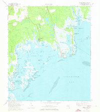
1972 Map of Spring Creek
USGS Topo · Published 1973About this map
Spring Creek and the surrounding marshlands of the St Marks National Wildlife Refuge define this coastal stretch of Wakulla County in the early 1970s. The map illustrates a landscape of complex hydrology where numerous freshwater creeks like Shepherd Spring Creek and Goose Creek meet the tidal flats of Oyster Bay and Apalachee Bay. Small fishing settlements and landings are scattered along the shoreline, including Stokley Landing, Wakulla Beach, and the Bottoms Fishery near Dickerson Bay.
Find a feature on this map
86 named features on this map. Tap any name to fly to it.
Don’t see what you’re looking for? This feature index may not catch every label — zoom into the map to look around manually.
Map Details
Editions of this 1972 Spring Creek Map
2 editions found
Other maps of this area

1940 · Arran
USGS Topo · 1:62,500

1943 · Arran
USGS Topo · 1:62,500

1943 · St. Teresa Beach
USGS Topo · 1:24,000

1943 · Lighthouse Point
USGS Topo · 1:24,000

1945 · Lighthouse Point
USGS Topo · 1:31,680

1945 · St Teresa
USGS Topo · 1:31,680

1949 · Apalachicola
USGS Topo · 1:250,000

1954 · Sprague Island
USGS Topo · 1:24,000

1954 · St. Marks
USGS Topo · 1:24,000

1954 · Tallahassee
USGS Topo · 1:250,000