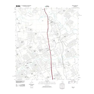
2010 Map of Spring
USGS Topo · Published 2010About this map
Spring Creek and Cypress Creek define the low-lying drainage of this North Houston landscape, as it transitioned from its petroleum-producing roots into a dense network of suburban residential developments. While newer neighborhoods like Bridgestone West and Lexington Woods fill the terrain, several older landmarks remain. The Goodyear Airship Operations Airport stands as a notable aviation site, while numerous family-name burial grounds including the Wuensche Cemetery and Budde Cemetery provide a vital link to the area's early German-settler history. Petroleum activity is still visible in the northern reaches via the Bender Oil Field and Kuhlman Oil Field, demonstrating the area's ongoing industrial utility amidst suburban sprawl. A complex hydrological system of gullies, such as Seals Gully and Senger Gully, underscores the region's flat, flood-prone topography that shaped 21st-century civil engineering and road layouts like the Hardy Toll Rd.
Find a feature on this map
94 named features on this map. Tap any name to fly to it.
Don’t see what you’re looking for? This feature index may not catch every label — zoom into the map to look around manually.
Map Details
Editions of this 2010 Spring Map
This is the sole edition of this map. No revisions or reprints were ever made.
Other maps of this area

1916 · Aldine
USGS Topo · 1:24,000

1916 · Louetta
USGS Topo · 1:24,000

1916 · Satsuma
USGS Topo · 1:24,000

1916 · Humble
USGS Topo · 1:24,000

1916 · Spring
USGS Topo · 1:24,000

1919 · Aldine
USGS Topo · 1:31,680

1919 · Humble
USGS Topo · 1:31,680

1919 · Weeden
USGS Topo · 1:31,680

1920 · Spring
USGS Topo · 1:31,680

1920 · Louetta
USGS Topo · 1:31,680