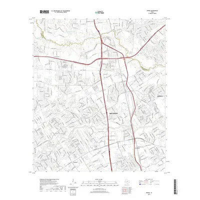
2019 Map of Spring
USGS Topo · Published 2019About this map
Spring Creek and Cypress Creek define the hydrologic character of this area north of Houston, where the boundary between Montgomery and Harris counties follows the winding course of the water. The landscape is a mix of established residential developments and older local identifiers like Westfield and Bammel. Deeply rooted community history is preserved in several small burial grounds, including the Wunsche Cem and Budde Cem, which stand as markers of early families amidst the modern infrastructure of the I-45 corridor.
Find a feature on this map
404 named features on this map. Tap any name to fly to it.
Don’t see what you’re looking for? This feature index may not catch every label — zoom into the map to look around manually.
Map Details
Editions of this 2019 Spring Map
This is the sole edition of this map. No revisions or reprints were ever made.
Other maps of this area

1916 · Aldine
USGS Topo · 1:24,000

1916 · Louetta
USGS Topo · 1:24,000

1916 · Satsuma
USGS Topo · 1:24,000

1916 · Humble
USGS Topo · 1:24,000

1916 · Spring
USGS Topo · 1:24,000

1919 · Aldine
USGS Topo · 1:31,680

1919 · Humble
USGS Topo · 1:31,680

1919 · Weeden
USGS Topo · 1:31,680

1920 · Spring
USGS Topo · 1:31,680

1920 · Louetta
USGS Topo · 1:31,680