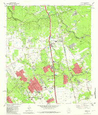
1982 Map of Spring
USGS Topo · Published 1982About this map
Spring and the surrounding Harris County suburbs appear in a period of rapid residential expansion along the Missouri Pacific Railroad. Subdivisions are spreading west toward Klein Park and south toward Bammel, while the landscape retains significant traces of its rural roots through family-named landmarks like the Budde Cem, Wunsche Cem, and Mueschke Cem. The importance of local aviation is evident with the Skyline Airport and a dedicated Landing Field (Blimp) located near the railroad corridor.
Find a feature on this map
79 named features on this map. Tap any name to fly to it.
Don’t see what you’re looking for? This feature index may not catch every label — zoom into the map to look around manually.
Map Details
Editions of this 1982 Spring Map
This is the sole edition of this map. No revisions or reprints were ever made.
Other maps of this area

1916 · Aldine
USGS Topo · 1:24,000

1916 · Louetta
USGS Topo · 1:24,000

1916 · Satsuma
USGS Topo · 1:24,000

1916 · Humble
USGS Topo · 1:24,000

1916 · Spring
USGS Topo · 1:24,000

1919 · Aldine
USGS Topo · 1:31,680

1919 · Humble
USGS Topo · 1:31,680

1919 · Weeden
USGS Topo · 1:31,680

1920 · Spring
USGS Topo · 1:31,680

1920 · Louetta
USGS Topo · 1:31,680