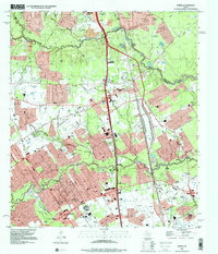
1995 Map of Spring
USGS Topo · Published 2000About this map
The boundary between Montgomery and Harris Counties is defined by the winding course of Spring Creek, a landscape undergoing significant suburban transformation in the mid-1990s. The established settlement of Spring sits at the heart of the map, surrounded by an expanding network of residential developments and institutions including Spring High Sch and Wunsche High Sch. This era captures a mix of legacy agricultural footprints alongside massive modern infrastructure, such as the Hardy Toll Road and Interstate 45 corridors that dominate the north-south transit. Significant genealogical data is preserved through numerous family and community burial grounds, such as Wunsche Cem, Budde Cem, and Mueschke Cem. Along Cypress Creek, the southern portion of the map shows the growth of Westfield and Bammel, where new educational centers like North Harris County College were established to serve the burgeoning population near Louetta Road and Cypresswood Drive.
Find a feature on this map
54 named features on this map. Tap any name to fly to it.
Don’t see what you’re looking for? This feature index may not catch every label — zoom into the map to look around manually.
Map Details
Editions of this 1995 Spring Map
This is the sole edition of this map. No revisions or reprints were ever made.
Other maps of this area

1916 · Aldine
USGS Topo · 1:24,000

1916 · Louetta
USGS Topo · 1:24,000

1916 · Satsuma
USGS Topo · 1:24,000

1916 · Humble
USGS Topo · 1:24,000

1916 · Spring
USGS Topo · 1:24,000

1919 · Aldine
USGS Topo · 1:31,680

1919 · Humble
USGS Topo · 1:31,680

1919 · Weeden
USGS Topo · 1:31,680

1920 · Spring
USGS Topo · 1:31,680

1920 · Louetta
USGS Topo · 1:31,680