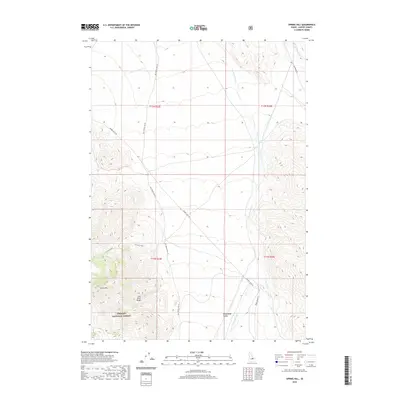
2020 Map of Spring Hill
USGS Topo · Published 2020About this map
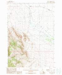
The Lost River Range dominates this Custer County landscape, where the peaks of the high country meet the broad Pahsimeroi Valley. This 2020 survey documents a transition from the protected woodlands of the Challis National Forest to the drainage basins of the Pahsimeroi River. Local hydrology is defined by mountain-fed streams like Doublespring Cr, Goldburg Cr, and the secluded Carlson Lake high on the slopes near Spring Hill. Transport across these remote ranges is limited to primitive routes such as Donkey Hills Rd and the Nat For Dev Rd 118. This modern data from the U.S. Geological Survey provides a precise view of the topography and public land boundaries at the intersection of T11N and T12N, capturing the character of Idaho's high-desert ranching and forest interface.
Find a feature on this map
18 named features on this map. Tap any name to fly to it.
Don’t see what you’re looking for? This feature index may not catch every label — zoom into the map to look around manually.
Map Details
Editions of this 2020 Spring Hill Map
This is the sole edition of this map. No revisions or reprints were ever made.
Other maps of this area

1935 · Borah Peak
USGS Topo · 1:125,000

1938 · Borah Peak
USGS Topo · 1:125,000

1955 · Dubois
USGS Topo · 1:250,000

1956 · Donkey Hills
USGS Topo · 1:62,500

1956 · Doublespring
USGS Topo · 1:62,500

1958 · Dubois
USGS Topo · 1:250,000
1967 · Burnt Creek
USGS Topo · 1:24,000
1967 · Borah Peak
USGS Topo · 1:24,000
1967 · Short Creek
USGS Topo · 1:24,000
1989 · Mahogany Hill
USGS Topo · 1:24,000