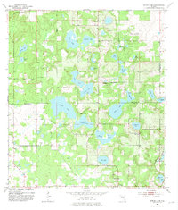
1954 Map of Spring Lake
USGS Topo · Published 1981About this map
Spring Lake and the surrounding orange grove country of central Florida are defined by a complex network of solution basins and sinkhole lakes. This mid-century survey captures the region along the Hernando Co and Pasco Co line, where the landscape transitions from the heights of Hickory Hill down to sprawling water bodies like Hancock Lake and Mud Lake. The settlement pattern is largely rural and dispersed, anchored by community landmarks such as Mt Pleasant Ch and the Bay Spring Sch.
Find a feature on this map
39 named features on this map. Tap any name to fly to it.
Don’t see what you’re looking for? This feature index may not catch every label — zoom into the map to look around manually.
Map Details
Editions of this 1954 Spring Lake Map
5 editions found
Other maps of this area

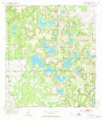
1954 · Spring Lake
USGS Topo · 1:24,000

1954 · Ehren
USGS Topo · 1:24,000

1954 · San Antonio
USGS Topo · 1:24,000

1954 · Brooksville
USGS Topo · 1:24,000

1954 · Masaryktown
USGS Topo · 1:24,000

1954 · Brooksville SE
USGS Topo · 1:24,000

1955 · Plant City
USGS Topo · 1:250,000

1958 · Plant City
USGS Topo · 1:250,000

1958 · Saint Catherine
USGS Topo · 1:24,000

1959 · Plant City
USGS Topo · 1:250,000