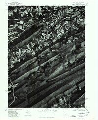
1977 Map of Spring Mills
USGS Topo · Published 1979About this map
Penn Valley serves as the focal point for this orthophoto study, showcasing the agricultural patterns of central Pennsylvania in the late 1970s. The village of Spring Mills sits at a critical bend in the landscape where Penn Creek cuts through the valley floor. Unlike traditional line-drawn maps, this aerial imagery reveals the precise contour of individual farm fields and woodlots tucked between the prominent ridges of First Mountain and the adjacent Mountain. This perspective provides a rare view of rural land use as it existed before late-twentieth-century development, documenting the relationship between the watercourse and the surrounding limestone valley soil.
Find a feature on this map
5 named features on this map. Tap any name to fly to it.
Don’t see what you’re looking for? This feature index may not catch every label — zoom into the map to look around manually.
Map Details
Editions of this 1977 Spring Mills Map
This is the sole edition of this map. No revisions or reprints were ever made.
Other maps of this area

1924 · Centre Hall
USGS Topo · 1:62,500

1924 · Lewistown
USGS Topo · 1:62,500

1925 · Mifflintown
USGS Topo · 1:48,000

1927 · Lewisburg
USGS Topo · 1:62,500

1929 · Centre Hall
USGS Topo · 1:62,500

1934 · Mifflintown
USGS Topo · 1:62,500

1937 · Mifflintown
USGS Topo · 1:62,500

1937 · Millheim
USGS Topo · 1:48,000

1941 · Millheim
USGS Topo · 1:62,500

1943 · Lewistown
USGS Topo · 1:125,000
Featured Places
- Farmers Mills, Gregg Township
- Beaverdam, Gregg Township
- Spring Mills, Gregg Township
- Gregg Township, PA
- Penn Hall, Gregg Township