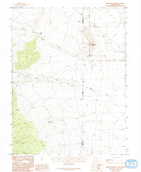
1986 Map of Spring Mountain
USGS Topo · Published 1994About this map
The arid borderlands of the Great Basin are defined by the convergence of the White Pine and Millard county lines at the Nevada-Utah state boundary. This mid-1980s survey illustrates a landscape of intermittent drainage and topographical landmarks, centered on the summit of Spring Mountain. The terrain transitions from the steep descent of Devils Gate and Petes Knoll in the west into a network of dry washes and seasonal watercourses. Features like Indian George Wash, Swan Creek, and Marble Wash dominate the eastern slopes, illustrating the complex alluvial patterns characteristic of the region. The presence of Warm Springs near the foot of the mountain suggests a localized hydrothermal influence amidst the surrounding high-desert environment, while the proximity of the state line reflects the administrative divisions of this sparsely settled territory.
Find a feature on this map
10 named features on this map. Tap any name to fly to it.
Don’t see what you’re looking for? This feature index may not catch every label — zoom into the map to look around manually.
Map Details
Editions of this 1986 Spring Mountain Map
2 editions found
Other maps of this area

1908 · Fish Springs
USGS Topo · 1:250,000

1910 · Fish Springs
USGS Topo · 1:250,000

1953 · Delta
USGS Topo · 1:250,000

1956 · Ely
USGS Topo · 1:250,000

1958 · Delta
USGS Topo · 1:250,000

1959 · Ely
USGS Topo · 1:250,000

1960 · Gandy
USGS Topo · 1:62,500

1961 · Trout Creek
USGS Topo · 1:62,500

1962 · Delta
USGS Topo · 1:250,000

1963 · Ely
USGS Topo · 1:250,000