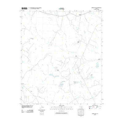
2010 Map of Spring Seat
USGS Topo · Published 2010About this map
Flynn and the namesake settlement of Spring Seat anchor this rural Texas landscape during the early twenty-first century. The area is characterized by a dense network of water bodies and minor watercourses, including Easterling Lake, Lake Reed, and Simms Lake, many of which were formed by small-scale dams like the Herbert Cryar Dam. These water resources supported the agricultural and ranching lifestyle of Leon County, visible in the scattered homesteads and cemetery sites. Genealogical researchers can locate several historical burial grounds, notably Seale Cemetery near Redland and the Spring Creek Cemetery situated near the headwaters of Spring Creek. The terrain is generally low-lying, punctuated by Hayden Mountain in the east and drained by numerous tributaries such as Boggy Creek and Mustang Creek.
Find a feature on this map
50 named features on this map. Tap any name to fly to it.
Don’t see what you’re looking for? This feature index may not catch every label — zoom into the map to look around manually.
Map Details
Editions of this 2010 Spring Seat Map
This is the sole edition of this map. No revisions or reprints were ever made.
Other maps of this area

1953 · Palestine
USGS Topo · 1:250,000

1954 · Waco
USGS Topo · 1:250,000

1955 · Waco
USGS Topo · 1:250,000

1956 · Jewett
USGS Topo · 1:62,500

1957 · Palestine
USGS Topo · 1:250,000

1964 · Centerville
USGS Topo · 1:24,000

1964 · Spring Seat
USGS Topo · 1:24,000

1964 · Leona
USGS Topo · 1:24,000
1964 · Normangee
USGS Topo · 1:24,000
1964 · Hilltop Lakes
USGS Topo · 1:24,000